Jim Steele
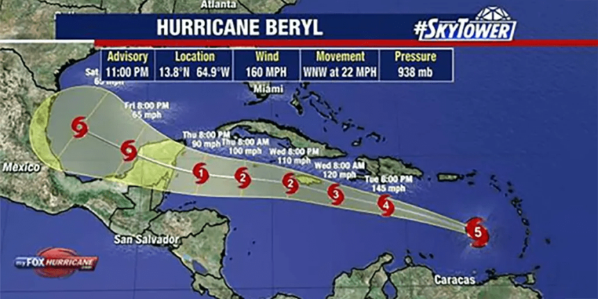
Hurricane Beryl intensified from a tropical depression to a major hurricane in just 42 hours. How can the ocean provide heat so quickly to increase the intensity of hurricanes in such a short period of time, as they travel northward into cooler ocean waters?

Storm intensification is controlled by 3 dynamics. 1) Energy provided by sea surface temperature; 2) Wind shear that increases during El Nino and ENSO years is neutral and disrupts the storm structure needed to become a strong hurricane; 3) The Ocean Barrier Layer that prevents storms from absorbing colder subsurface water that normally prevents intensification, also creates a layer of warmer than normal water that provides the extra heat needed to intensify the storm.
Barrier layers are key to understanding intensification, but are rarely applied in fearmongering media. Storms intensify when a sub-surface Barrier layer forms and prevents hurricanes from drawing in naturally cold subsurface water that prevents further intensification. The barrier layer prevents the ascent of cold water, as well as providing extra stored heat that increases intensification.
The barrier layer forms when fresh water overlays warm salt water prevents convection that ventilates subsurface heat and causing the accumulation of heat below the surface. In the Caribbean, the Barrier Layer is generally formed when freshwater pools from the Amazon and Orinoco Rivers flow northward into the Caribbean. Sing peak river discharge in Juneso the intensification of Beryl off the coast of Venezuela in June is not unusual!
The formation of the barrier layer is patchy based on the coincidence of freshwater currents covering warm ocean currents. The barrier layer is short. Thicker barrier layers last more than 30 days and thinner layers last less. Different patterns of local barrier layers mean that we see hurricanes intensifying in one location along the storm track but only for a short period of time, a day or less. The thicker the Barrier Layer, the more storms intensify, and the duration of strong hurricanes.

Beryl will likely decrease in intensity after Tuesday July 2, 2024 as it moves north beyond the transport of a thicker barrier layer off the coast of Venezuela. The dynamics of this barrier layer are now more often studied, so its effects are rarely discussed, nothing is shown in the fear-mongering media. But read https://news.miami.edu/stories/2018/09/how-does-a-river-plume-influence-hurricanes-in-the-caribbean.html
Ma (2023) “Interannual Variability of the Barrier Layer in the Tropical Atlantic and Its Relationships with Tropical Atlantic Mode” provides a good analysis of the Barrier Layer.
Ma wrote, “Since the importance of the Barrier Layer has been revealed, many studies have discussed the formation mechanism in the Atlantic Ocean using observational data. Masson and Delecluse (2001) found that during the boreal and spring seasons, freshwater from the Amazon River flows over the surface along the northern coast of South America, resulting in a thicker BL in this region..”
As described by Ma (2023), the freshwater plume that allowed the Barrier Layer to develop slowly moved northward into the Gulf of Mexico. The BLT (Barrier Layer Thickness) along the coast of Venezuela, where Beryl is intensifying, is greatest in winter and spring, then thins in summer and is thinnest in September-November.

I will predict that Hurricane Beryl will now quickly weaken because it outpaces the movement north of the Barrier Layer which provided the heat required for the intensification to category 4 & 5 hurricanes. It is pure rain that allows the track of tropical storms to coincide with the thick Barrier Layer, which causes the rapid intensification of Beryl. However, to observe the same one or two-day period of hurricane intensification was impossible before the age of satellites in the late 1970s, and we will never know how unusual Hurricane Beryl was in history.


