



Africa is coming apart, and geologists have spent decades arguing about what is doing the pulling.
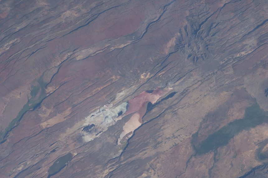
One camp held that the East African Rift — the 3,500-kilometre scar running from the Afar region of Ethiopia down through Kenya and Tanzania towards Mozambique — is being stretched from the sides, the ordinary business of tectonic plates drifting apart. Another held that something deeper is at work: a vast column of hot rock rising from the boundary between Earth’s core and its mantle, roughly 2,900 kilometres below the surface, pushing upward against the underside of the continent.
New modelling work from Virginia Tech, publicised at the end of August, makes the case that the deep explanation is doing more of the work than the surface one — and, crucially, that it explains a puzzle the surface model never could.
The problem with the simple explanation
If the rift were being opened purely by plates pulling apart, the ground either side of it should be moving in one obvious direction: away from the rift, roughly east and west. That is what the textbook picture predicts, and for much of the rift it is broadly what happens.
But not everywhere. In several segments, GPS stations planted across the region have recorded crust moving along the rift — northward, parallel to the crack rather than perpendicular to it. That motion has no straightforward explanation in a model driven only by plate-boundary forces.
A team led by Tahiry Rajaonarison, now a postdoctoral researcher at New Mexico Tech, who completed his doctorate at Virginia Tech, combined three-dimensional thermomechanical computer models with more than a decade of GPS deformation measurements to test what would happen if the African Superplume were factored in. When the models included northward flow in the deep mantle beneath the continent, the anomalous surface motion fell into place.
“The mantle flow… may be causing the anomalous northward deformation parallel to the rift,” Rajaonarison said in a summary of the work released by Virginia Tech.
The senior author, D. Sarah Stamps, associate professor of geosciences at Virginia Tech, has spent years running the GPS network that supplied the surface measurements. The underlying paper appeared in Geophysical Research Letters (vol. 52, issue 20, 2025; DOI 10.1029/2025GL116301) and builds on modelling the same group published in 2021.
Why the same rock cracks in one place and stretches in another
Part of what the rift makes visible is that the Earth’s outer layers do not behave in a single, consistent way. In some segments the crust fractures sharply, opening fissures. In others it thins and stretches smoothly, like dough being pulled.
Stamps reaches for a toy to explain it. Silly Putty, left alone, sags and flows. Hit it hard and it shatters. “If you hit Silly Putty with a hammer, it can actually crack and break,” she said. The variable is not the material but the speed at which force is applied — and rock, on geological timescales, behaves the same way. Where stress accumulates quickly, the crust breaks; where it builds slowly, the crust flows.
That is why a single rift can look like a clean tear in one place and a gentle sag a few hundred kilometres away, without needing two separate explanations.
A second line of evidence, from noble gases
The modelling result does not stand alone. A separate 2025 study led by Biying Chen, a postdoctoral research associate at the University of Edinburgh’s School of Geosciences, approached the same question from an entirely different direction: by measuring neon isotopes in geothermal gases venting from the Kenya Rift.
Noble gases are useful precisely because they are chemically inert. They do not react on the way up, so their isotopic fingerprint survives the journey from wherever they started. Chen’s team found that gases emerging from different segments of the rift carried a strikingly consistent deep-mantle signature — pointing to one shared source rather than several unrelated shallow ones.
“The deep mantle signatures observed in different segments of EARS are remarkably similar,” Chen said.
Two independent methods — computer models of how rock deforms, and chemical analysis of gas seeping out of the ground — converging on the same answer is the kind of agreement that moves a hypothesis toward consensus.
What this does not mean
It is worth being precise about the timescale, because this story is regularly told with more drama than the evidence supports.
The East African Rift has been actively opening for roughly 35 million years. It is doing so at a rate measured in millimetres per year — slower than a fingernail grows. Nothing in this research suggests the process is accelerating, and nothing in it points to a new ocean appearing on any timescale a human being would notice. The often-repeated claim that Africa will “split in two” reads very differently once the units are attached: the eventual separation, if the rifting continues, is a matter of millions of years.
What has changed is not the forecast but the explanation. Researchers now have a mechanism that accounts for the awkward observations rather than setting them aside.
Why it matters beyond geology
The rift is not an abstraction for the people who live along it. It hosts some of East Africa’s most active volcanoes and a persistent earthquake hazard, and it is also the reason the region has world-class geothermal energy potential — Kenya draws a substantial share of its electricity from geothermal plants sited on exactly the heat anomaly this research describes.
Understanding what drives the deformation, and why particular segments behave as they do, feeds directly into hazard assessment and into deciding where the next geothermal field is worth drilling.
What comes next
Continued GPS monitoring and further isotope and seismic work across the Kenyan, Malawian and Mozambican segments will test whether a single-superplume model holds across the whole rift system, or whether the picture fragments once more data arrives. No specific fieldwork timetable was disclosed with the current release.
How you measure a continent pulling apart
The claim that East Africa is moving rests on GPS geodesy, and the precision involved is worth appreciating.
Permanent GPS receivers bolted to bedrock record their positions continuously for years. Individual readings are noisy — atmospheric conditions, satellite geometry and instrument drift all introduce error. But averaged over years, and with those errors modelled out, the residual signal resolves motion at the level of millimetres per year.
That is the raw material. The East African Rift opens at a rate comparable to fingernail growth, which is invisible in any human timeframe and unmistakable in a decade of continuous measurement.
What makes the rift analytically interesting is that this motion is not uniform. Different segments move at different rates and, critically, in different directions. It is the directions that carry the information: a plate-boundary force pulling east-west should produce east-west motion. Where the crust instead moves northward, parallel to the rift, something else is acting on it. That anomaly is the observation the new modelling was built to explain.
What a superplume actually is
The African Superplume is not a narrow pipe of magma. It belongs to a class of features known as large low-shear-velocity provinces — enormous regions at the base of the mantle, near the boundary with the liquid outer core roughly 2,900 kilometres down, through which seismic waves travel unusually slowly.
Slower waves imply material that is hotter, chemically distinct, or both. There are two such provinces on Earth: one beneath Africa, one beneath the Pacific. Together they occupy a substantial fraction of the lowermost mantle.
The word “plume” invites the wrong picture. This is not molten rock rising like smoke. It is solid rock, buoyant relative to its surroundings and deforming plastically over geological time — flowing in the sense that a glacier flows.
The description “primordial” appears in some coverage because there is evidence, including from noble-gas isotopes, that material in these provinces has been isolated from the convecting mantle for a very long time — possibly since near the Earth’s formation. If so, gases venting along the Kenya Rift are samples of a reservoir that has barely mixed in four billion years.
Why this argument has run for so long
The dispute between “plate forces” and “plume forces” is one of the long-running arguments in geodynamics, and it persists because both mechanisms predict roughly similar surface geometry.
Rifting driven from the sides produces a rift valley. Rifting driven from below also produces a rift valley. Distinguishing them requires evidence beyond the shape of the landscape — the fine detail of motion directions, seismic imaging of the deep interior, and the chemical fingerprint of what emerges.
The value of the current work is that it uses two independent lines of evidence pointing the same way. Neither alone would settle it. Modelling can be tuned; isotope data can be interpreted more than one way. Agreement between methods with entirely different failure modes is what moves a hypothesis toward acceptance.
The hazard, and the resource
The same heat produces both the danger and the opportunity, and the region lives with both.
The hazard. The rift hosts some of Africa’s most active volcanoes and a persistent earthquake risk. Nyiragongo in the Democratic Republic of the Congo, with its unusually fluid lava, has produced flows that moved fast enough to overtake people fleeing them — a rare and specific danger. Ol Doinyo Lengai in Tanzania erupts carbonatite lava, cool and dark enough that it appears black by day. Millions live within reach of these systems.
The resource. The same shallow heat makes East Africa one of the best geothermal provinces on the planet. Kenya draws a substantial share of its electricity from geothermal plants, notably in the Olkaria field, and geothermal has an advantage renewables generally lack: it runs continuously, independent of weather or daylight, which makes it usable as baseload rather than intermittent supply.
Research into what drives the rifting is not abstract in this context. Knowing where heat is concentrated and how the crust is deforming is what determines where the next geothermal field is worth drilling, and how the associated seismic risk should be assessed.
The timescale, stated once more
The phrase “Africa is splitting in two” is accurate and almost always misleading, because the units get dropped.
The Red Sea and the Gulf of Aden are what a completed version of this process looks like — former rifts that opened far enough for the sea to enter. That took tens of millions of years. The East African Rift has been active for roughly 35 million years and is, on the most straightforward reading, somewhere in the middle of the same sequence.
Nothing in this research suggests acceleration. No coastline will change in any span a person or a nation plans for. What the work offers is not a forecast but an explanation — of a mechanism that has been operating steadily since long before there were humans to notice it.
Sources
- Virginia Tech / ScienceDaily, “A massive plume deep beneath Africa is pulling the continent apart,” 31 August 2026 — sciencedaily.com
- Rajaonarison, T. et al., “Constraining the Kinematics of the Victoria Microplate and the Northern Western Branch of the East African Rift System,” Geophysical Research Letters 52(20), 2025, DOI 10.1029/2025GL116301 — AGU Publications
- Live Science, “‘Primordial’ superplume of deep mantle splitting Africa in two, study suggests,” 2026 — livescience.com